Disaster planning
Infrastructure in a changing climate

In recent years, the Middle East has experienced some of the most extreme weather ever recorded, and the region hasn’t always been prepared. Dan McAlister finds out about a new software package that will help protect civil infrastructure against the changing climate
It’s important to recognise the Middle East as a whole was not really in the mindset to consider flooding as a major problem and it would have been difficult even ten years ago to foresee the differences in climate that we’re now seeing,” says Chris Palfreyman, executive sales director for Bentley Dubai.
Last month saw unprecedented flooding in Fujairah where an Emirati man was killed and two people were seriously injured. In 2010, almost 2000 lives were lost in Pakistan.
Bentley’s new system hopes to predict catastrophes like this in the future.
The recently launched GIS for Infrastructure programme is designed to improve safety in cities along with addressing other issues, such as preventing overcrowding in town planning.
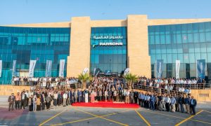
At a recent talk at the Madinat Jumeirah, Dubai, a selection of Bentley’s top sales executives gave talks on how to advance GIS for infrastructure and improve efficiency of water use and wastewater networks. Some of the top engineers from Arabtec, Parsons and Danway were there to hear about the new system.
“With the water industry we cover a variety of things starting with the modeling of the network, how to manage the network with other softwares in the market that are compatible with ours, so we compete with the other Computer Aided Design (CAD) designers. We also have very strong structures for water, waste management and the whole network of waste water and then we cover the storm and flood analysis,” says Talal Shawwa, sales director of water.
“This analysis is actually one of the strongest on the market and we’ve got tools that mange existing networks and new urban changed networks coming up for areas that are being developed, like the ones in Dubai. So we can manage the whole area to avoid flooding and storm water coming out of the drainage system.
“The third one is actually a solution that helps us control floods, such as the ones that happened recently in Dubai, but mainly in Oman, Jeddah and Riyadh, and other places in the region,” says Shawwa.
“It seems that the whole atmosphere is changing, the weather is changing. It’s really important for this part of the world, especially as it was not designed with proper flooding in mind and now it’s occurring almost annually. So this is where our strength comes from,” Shawwa continues to comment.
Bentley hopes to be able to predict disasters before they happen. The company also hopes to work with authorities to plan and implement warning systems along with disaster management when the worst does happen.
“The plan is to actually build some kind of alarm system so once you have the floods you alarm people. We can send SMSs to inform people which areas to avoid and let them know what to do in such cases. So that’s the whole situation, not just identifying but also what to do but how to manage the floods and handle emergency cases.
“When you ask how we approach that in UAE we’re starting of course with the concerned authorities,” Shawwa explains, adding that the company is presently working on stone water, with approaches to manage new and existing urban drainage systems – a predominant issue in Dubai where networks are designed for lower usage.
The second phase of this project will look into river-based analysis and near sea. The third involves advanced 2D and 3D software to analyse a district area.
“It’s a very expensive solution but it covers very specific areas like national health, police stations, government agencies, schools and such things,” Shawwa explains.
Along flood prevention, Bentley’s Oscar Custers explained his role within the company and took delegates on a virtual guided tour of Quebec.
“I look after the geospatial market, the GIS market in the region. We have a focus for utilities, communication, telecom and governmental agencies and deliver software for them, creating and publishing data with high precision.
“There’s a CAT setting underneath our GIS systems and on top of this CAT system we have specialised GIS operations to serve utility, telecom and governmental markets and we’re quite successful. We can do that in a 2D and 3D environment, especially 3D these days as it becomes ever more important and we are the market leader in that domain clearly,” Custers says.
The software links with users’ preferred interfaces, for example Google, and claims to never lose any information or work that a user produces – always a major plus point.
The Hague in the Netherlands, with overcrowding problems, is an example of a city that could be transformed by this product.
The science
“We can basically take a 2D environment extrude it through a 3D environment for the different technologies like laser scanning,” Custers begins.
“We can build 3D cities out of technologies easily. From there you really have a 3D model from which you can sell that to telecom companies or users from a utility perspective where you have your pipes on the ground or below ground.
“We can do analysis for the owner of a particular apartment – we can do that in full 3D, he continues, adding that the data can be used by organisations and emergency response teams from fire rescue to the military.
“There are many things for which we can use the data from a 3D model and that is really where the market is going now,” he explains.
Essentially Bentley started its life as a vendor of CAD software back in 1986. Formed by brothers in the US, the product they developed was called MicroStation – now the station of choice for the major global AEC companies.
Bentley’s other major clients in the GCC include Sharjah Town Planning, Dubai Municipality, Abu Dhabi Distributional Company, DEWA, Etislat and most recently Du. Among the civil engineers there are Halcrow, McDonalds and WS Atkins.
“I think the key to our success has really been specialisation,” alludes Palfreyman.
“We only really specialise in areas we believe that we’re good at and that’s really infrastructure.
“There isn’t anybody around that knows more about infrastructure software than Bentley does,” Palfreyman continues, pledging the company will “be there when the rebuilding of Libya begins”.
Bentley may already belong to the world’s second biggest GIS software designing organisation, but they are aiming higher.


