Dubai Municipality launches emirate-wide Soil Map project
Accredited contractors and consultants will be given access to project data

The Dubai Municipality (DM) has launched what it claims is the Middle East’s largest smart geological project. The Soil Map project will produce interactive soil maps of locations across Dubai, and the data will be accessible to firms planning large construction projects.
The project aims to simplify work procedures, reduce the consumption of paper, conserve natural resources, and reduce the per capita consumption of gasoline. The initiative is in line with the DM’s Zero Visit Strategy.
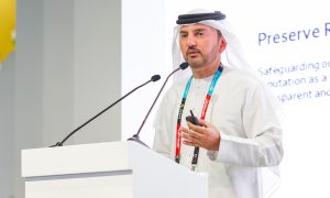
“The Soil Map project’s valid uses are particularly significant because of the importance of maps in the design and construction of buildings. Geological studies have to be conducted before the establishment of large projects, such as dams, bridges, tunnels, and high-rise towers. It’s also important to provide comprehensive records supported with maps of each area in the emirate of Dubai in a central and unified database,” said Eng Hussain Nasser Lootah, Dubai Municipality’s director general.
Lootah also pointed out that the project aims to facilitate the use of interactive soil maps in the study and analysis of soil-related data, such as soil type, soil layers, groundwater levels, and chemical and physical properties.
“The project will save the time, effort, and money of real estate agents, and help employees to retrieve data and carry out the necessary analysis. It will also contribute by providing two-dimensional soil maps, and correct soil report data in a unified central database,” added Lootah.
The Soil Map Project’s data entry system will be introduced to contractors and consultants accredited by and registered with DM through training workshops.
Eng Maryam Al Muhairi, director of DM’s geographic information system (GIS) department concluded, “All the data of the soil reports in the municipality is on paper; there is no electronic system of soil data, and the soil reports are checked and approved manually. Hence, the proposal was to convert the soil report data from paper to digital, and to design a system for the automatic data entry of soil and the automatic checking of data, as well as the design of a soil data extraction system in the form of interactive maps showing soil layers, soil tolerance, and chemical properties of soil and water.


